The optimum yield of any crop, or even individual varieties, may depend on specific density requirements. These should be known and applied. Well-prepared cultivation recommendations give the optimum plant density, depending on the species, variety or habitat.
These recommendations are usually prepared on the basis of research results from breeding companies. For some crop species, such as wheat, such research is also carried out by COBORU. Good quality seed costs money and using excessive sowing simply does not pay off. This is still the trend when sowing with outgrown seed. In practice, excessive sowing, when poor quality seed is sown, can lead to lower yields due to overcrowding of the plants, their strong competition for light, water and nutrients and, consequently, exuberance, elongation, poorer overwintering, greater susceptibility to pathogens or lodging. Cultivation recommendations today very often give sowing rates in units of seed per square metre, separate for each variety, or planting of tubers per unit area. After taking into account the average natural plant losses during the growing season and the tillering ability in the case of cereals, the recommended number of seeds, or tubers, gives the optimum number of plants/shoots per unit area.
High seeding accuracy can only be ensured with a good seed drill, with a calibration test each time the seeding rate, species or variety is changed. Data on the actual crop density and compliance should be made visible in the crop/field document.
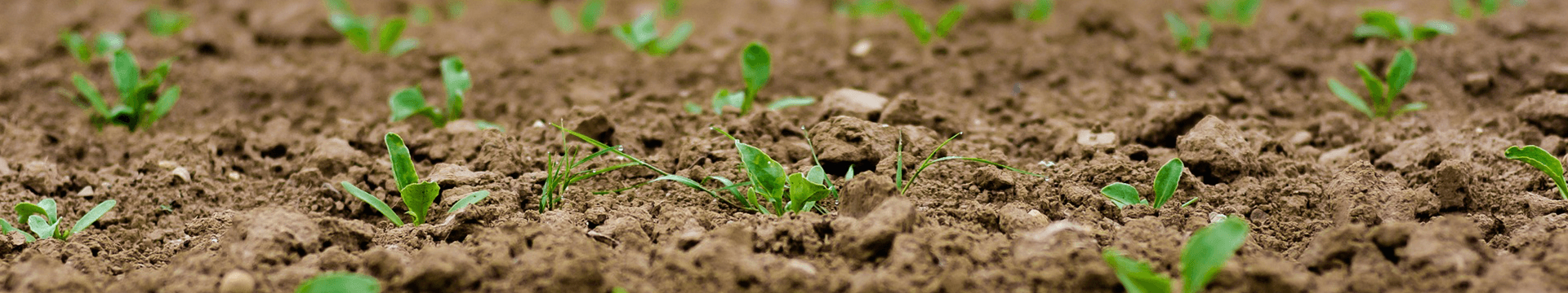
Today, the easiest and quickest way to document the condition of a crop canopy, including its density, is to take photographs. At the same time, it is a very easy way to disseminate and exchange knowledge among farmers or with an advisor. Photo documentation is very good material to use in the future when, for example, comparing canopy density between fields (e.g. different sites, varieties, sowing dates, protection programmes) or years (e.g. different sowing dates, weather conditions). However, it is essential for photo documentation to take reliable notes, ask questions and seek answers. Only by documenting in this way over the years does this become our “database”, which we refer to when we are looking for a solution to a problem. Nowadays, sending photos makes it possible to obtain advice even when our colleague or adviser is hundreds or thousands of kilometres away from our farm. Using photo documentation, it is also possible to receive advice from people in Polish and foreign agricultural services. Agricultural service companies offer applications for the telephone, where the photos serve as a source of knowledge, helping to quickly formulate cultivation recommendations.
A very accurate documentation of the condition and density of a crop canopy, but taken at the scale of entire fields, are aerial or drone photographs, where a single pixel – the smallest element seen in the image – can be as small as a few centimetres. Adapting plant density to local conditions, i.e. within a field, is already feasible thanks to the possibilities offered by precision farming tools.
The soil of each field is always varied and by sowing or planting at the same density over the entire field, we cause locally excessive or insufficient plant density. This is why it is important to define uniform soil zones in the field and to adapt the sowing density to the actual possibilities within the field. The basis for optimum sowing is the prior identification of zones with different productivity within the field, based on various spatial data sources, i.e. yield, soil-agricultural, topographic, soil electrical conductivity, aerial or satellite maps. A practical – and very precise – adaptation of the sowing density to the nature of the soil can be achieved by preparing maps for a so-called “variable seeding rate” using data from the soil scanner, combining this data with yield maps, monitoring of yields recorded in previous years, or with a map of the National Green Vegetation Index (NDVI) derived from satellite images or from a drone. An example of this is the maize seed sowing already in use, where, for example, 10-20% less seed per unit area is sown in less fertile areas of the field, and denser sowing is used in more fertile areas. Similar solutions are already being implemented in the cultivation of other crop species. After sowing, it is possible to draw up a variation map of the sowing rate, which can be compared with a yield map, e.g. of grain, after harvesting. For sowing a field with variable seeding density, we need a seed drill that can be controlled from a computer that adjusts the seeding rate to the actual capacity of the soil resulting from the combined electronic information. This will enable us to make optimal use of the seed, the soil resources (nutrients, water) for production and thus achieve an optimal production result. Variable-density sowing within a field is a solution currently used on a small number of farms. However, even on less technologically advanced farms, it is feasible in a much more simplified version. For example, on parts of the field always yielding lower grain yields or green matter, we sow the seed at a lower density – we can do the same with potato planting. Precision farming systems of various kinds can also help to optimise plant density, e.g. a parallel driving system based on GPS coordinates, which is accurate to within 2 cm when using correction signals.